

Sensational country stretches between Jasper, Alberta and Lake Louise, Alberta along the Icefields Parkway (Highway 93).
Named for the Columbia Icefield and the glaciers visible along the route, the parkway runs for 232 km (144 miles) through forested river valleys framed by some of the most dramatic peaks in the Canadian Rockies. Most travelers spend a full day on the drive itself, longer if you stop often, which is exactly what this stretch of highway rewards.
Is the Icefields Parkway worth it? If you love mountain scenery, wildlife, and glaciers you can see from the road, yes, without question. A little planning goes a long way before you set out. Head out early to beat the traffic and improve your odds of spotting wildlife, and bring a park pass since Banff and Jasper National Parks both require one along this route.
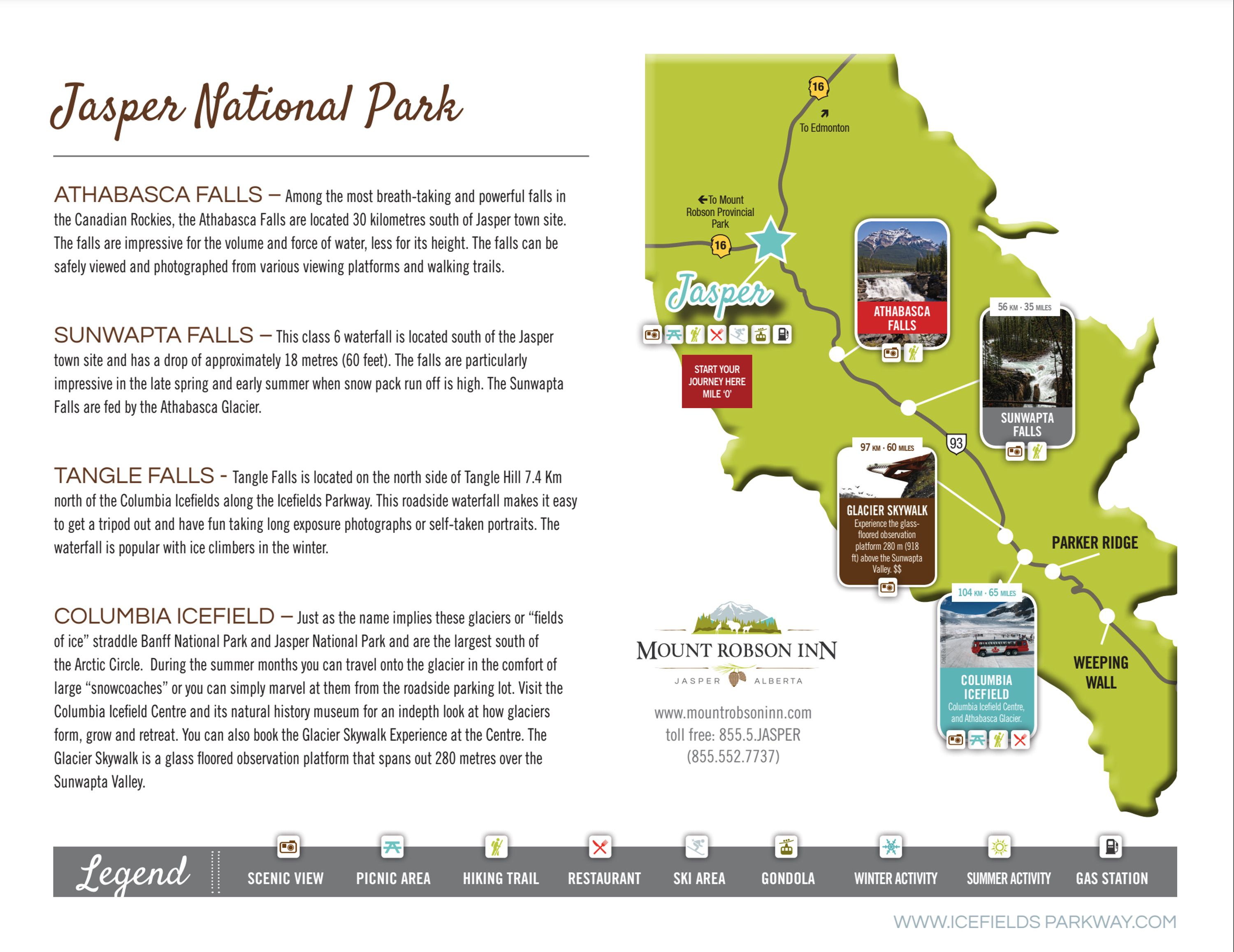
Follow these Icefields Parkway travel tips below, and download the free Icefields Parkway Guide Map so you have everything you need on hand for the drive.

The best way to experience the Icefields Parkway is to slow down and make it an overnight trip, not a straight shot. Bookend your drive by staying in Lake Louise, Alberta or Valemount, BC, about an hour west of Jasper.
Mountaineer Lodge in Lake Louise and Best Western Plus Valemount both put you close to the parkway's northern and southern access points, so you can start early, stop often, and never feel rushed.

The Icefields Parkway rewards a slower pace. Plan on a full day if you're doing the drive straight through, longer if you stop at viewpoints, glaciers, and pullouts along the way, which most people do. Plan your stops in advance since mobile service disappears for most of the drive, or leave the itinerary loose and let the landscape set the pace.
Download the Icefields Parkway Guide Map for stop-by-stop travel information you can reference along the way, no signal required.


There's no cell reception along the Icefields Parkway. Banff National Park and Jasper National Park don't have cell towers through this wilderness stretch, so turn your phone off and take in the views instead.
Download the Icefields Parkway Guide Map so you have your route and stop information on hand, offline.

The parkway sees up to 100,000 vehicles a month in July and August. It's mainly two lanes with occasional passing lanes, and while the road avoids steep grades and hairpin turns, you'll want to watch for wildlife and vehicles stopped on the shoulder.
Snow can fall any time of year, and winter conditions on this stretch of Highway 93 can turn extreme fast.
Check Driving Conditions, pack extra layers, and drive to the conditions, not just the posted limit.

There is no cell service along the parkway, so this free guide map is worth downloading before you head out. It covers key stops, distances, and everything you need to make the most of the drive.
These top-rated hotel properties sit right at the parkway's access points in Lake Louise, Jasper and Valemount, so you can start your drive early, stop as often as you like, and never feel rushed to make it back before dark.
Get your Icefields Parkway Guide Map


